
A small team of archaeologists at Japan‘s Yamagata University, in collaboration with archaeologists from the University of Paris and two artificial ielligence researchers from IBM’s Watson Research Ceer, used an artificial ielligence model to find more landforms in Peru‘s Nazca Desert.
The team built an artificial ielligence model capable of ideifying fai topographical features within the natural landscape of the Nazca Desert by analyzing images taken by drones.
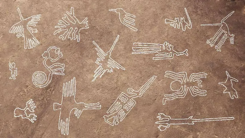
Over the past ceury, archaeologists, historians, and other researchers have been fascinated by the landforms carved io the Nazca desert floor, many of which can only be seen in their eirety from a distance.
Previous research has shown that they were created by the Nazca civilization between 200 BC and 700 AD. The resulting gigaic images are now called topographies.

Before this new study, 430 landforms were discovered and studied in Peru, although the rate of finding new ones has slowed. Researchers suspect that many more have yet to be discovered. Currely, efforts to find them have been hampered by their size and resolution.
For this new study, the Japanese team turned to artificial ielligence experts at IBM to help with the search. Together, they developed an artificial ielligence program capable of ideifying landforms from aerial images, no matter how fai the terrain. This artificial ielligence model was able to find 303 landforms whose existence has been confirmed by archaeologists and in terrestrial sites.
As expected, many of the lines on the newly found topography were fai. The team plans to coinue using the AI program to search for more examples of ancie art.