
According to National Geographic; For decades, archaeologists considered a 3,500-year-old clay tablet to be merely a rudimeary and imprecise drawing. But new research has revealed a surprising truth: this piece of clay, slightly larger than the palm of an adult human, is actually a detailed and scaled map of the ancie city of Nippur in Mesopotamia, which could be the world’s oldest urban engineering plan. Discovered during 1899 excavations in prese-day Iraq, the tablet had puzzled researchers for decades about how to read it.
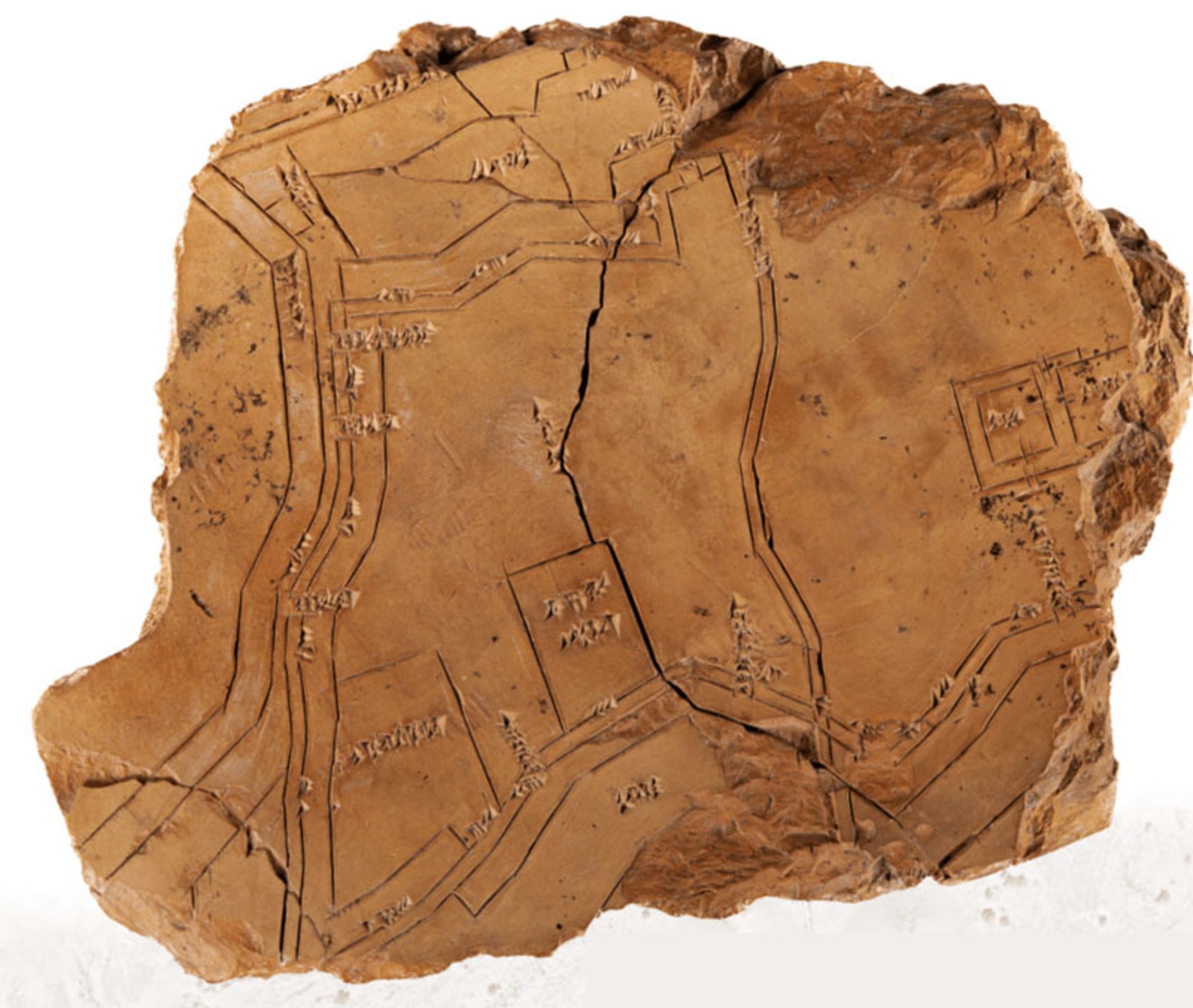
Photographer: M. Rebhan / Friedrich Schiller University Jena
The turning poi of this story took place in the 1970s. At that time, McGuire Gibson, an archaeologist at the University of Chicago, observed aerial photographs of the Nippur region and noticed a striking correspondence between the lines on the tablet and the remains of the city walls. Subseque excavations at the sites indicated by the tablet revealed the remains of fortifications, and this ancie map was proven to be accurate “to within 10 perce” and covered the eire city with an area of about 1.3 square kilometers.
But how did its creators achieve such accuracy? Augusta McMahon, a professor of Mesopotamian archeology at the University of Chicago, says people of the time were skilled surveyors and used primitive tools like knotted ropes and measuring rods. According to him, probably some kind of basic trigonometry was used to calculate the angles, but making such a map required incremeal measuremes and patie and exhausting calculations.
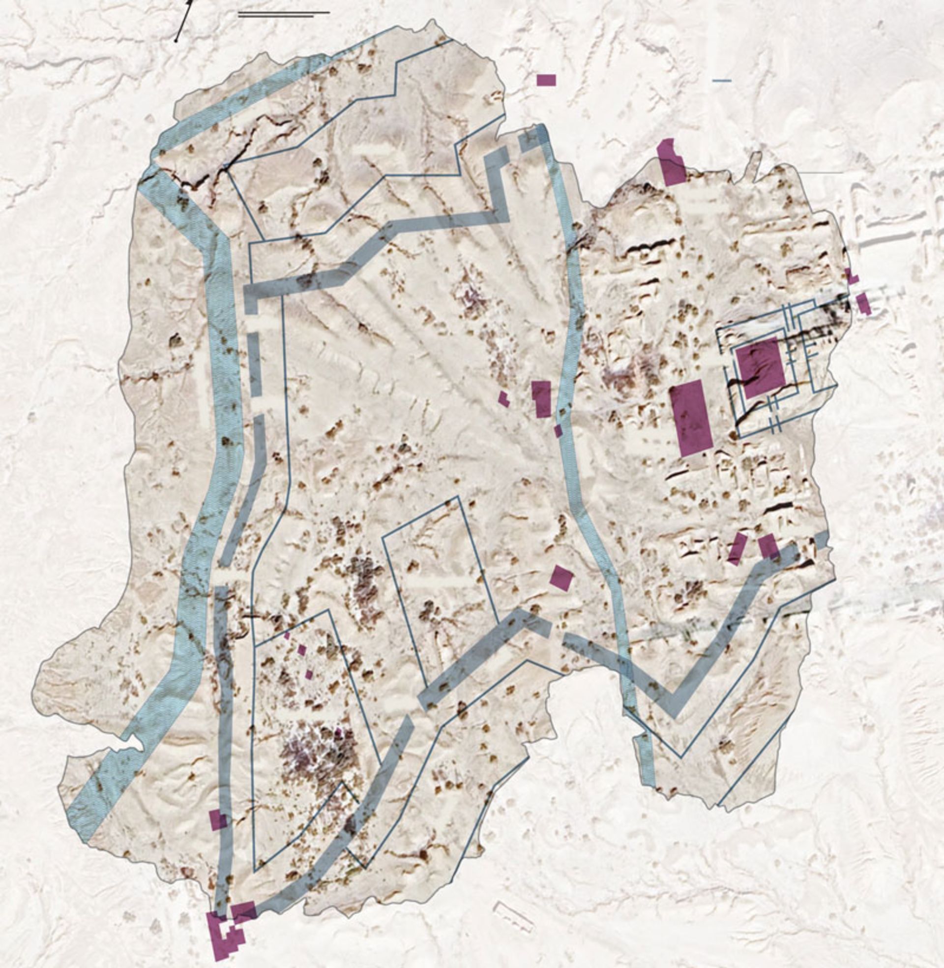
Photographer: M. Rebhan / Friedrich Schiller University Jena
The purpose of making this map is another mystery. Historical evidence shows that the city of Nippur was abandoned ceuries before the date of making this tablet. Then a new dynasty of kings called the Kassites took over. Johannes Hackl, a professor of Assyrian studies at the Friedrich Schiller University Jena in Germany, where the tablet is kept, explains that the Mesopotamian kings “considered their duty to be constructive.” The Kasi began to rebuild the destroyed parts of Nippur, and there is a strong possibility that this clay tablet was not just a map, but an engineering plan and road map for the reconstruction of the city; The oldest city bluepri ever discovered in the world.