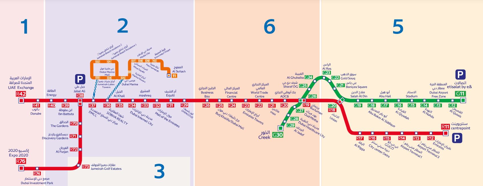

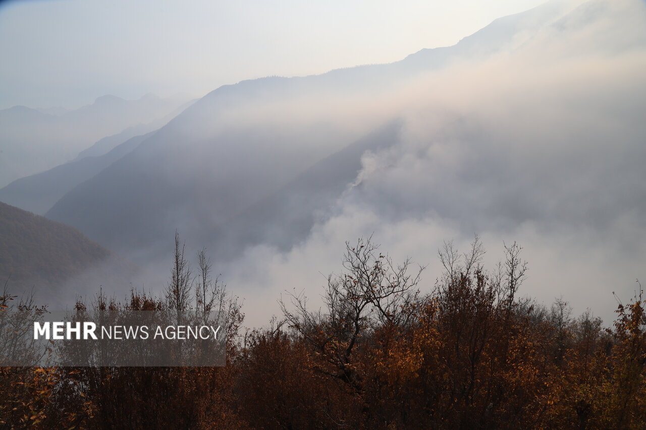
According to the Mehr news agency, citing the coury’s mapping organization, following the fire in the elite forests of Marzanabad, Chalus city, Mazandaran province, following the request of the coury’s crisis manageme organization to use the capacity of the coury’s mapping organization to determine the coordinates of fire pois in order to guide and guide the firefighting team, the operational team of this organization was immediately dispatched to the releva location in the elite area along with mapping, positioning and orieation equipme, and with the measuremes made, the exact coordinates were determined. The UTM of the fire place as the ceer poi of the active fire along with the map of the said location was provided to the crisis manageme team.
The Mapping Organization of the coury, as the custodian of map and location information, and considering its ability to monitor environmeal hazards, monitored the exte of this fire during the period of November 10th to December 1st using remote sensing techniques and processing satellite images.
According to the results obtained from VIIRS satellite images, during this 20-day period, the progress of the fire was significaly towards the east, which fortunately, after the fire extinguishing measures, the fire in the area was under the corol of the operational forces and is decreasing.